
1945 Map of Pickett Bay
USGS Topo · Published 1945About this map
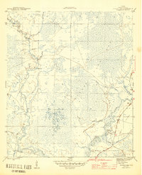
Tates Hell Swamp dominates this coastal Florida landscape, a complex drainage system of creeks and sloughs during the mid-1940s. The hydrography is intricately detailed, showing the meandering courses of the New River and Crooked River as they thread through the wetlands toward Pickett Bay. A significant historical marker is the site of Harbeson City (abandoned), located near the junction of the Crooked River and Cypress Slough. This settlement's status as abandoned by 1945 points to the shifting economic fortunes of the region's timber or naval stores industries. Navigation and land use are further evidenced by local landmarks such as Saw Bluff and the Thompson Cutoff, while numerous wells scattered throughout the swamp indicate early attempts to manage or utilize the water resources of this dense riparian environment.
Find a feature on this map
20 named features on this map. Tap any name to fly to it.
Don’t see what you’re looking for? This feature index may not catch every label — zoom into the map to look around manually.
Map Details
Editions of this 1945 Pickett Bay Map
4 editions found
Other maps of this area

1943 · Dog Island
USGS Topo · 1:31,680

1943 · Carrabelle
USGS Topo · 1:24,000

1944 · Pickett Bay
USGS Topo · 1:31,680

1944 · Carrabelle
USGS Topo · 1:31,680

1944 · Green Point
USGS Topo · 1:31,680

1945 · Thousand Yard Bay
USGS Topo · 1:31,680

1945 · Tates Hell Swamp
USGS Topo · 1:31,680

1945 · Mc Intyre
USGS Topo · 1:31,680

1945 · Sanborn
USGS Topo · 1:31,680

1946 · Owens Bridge
USGS Topo · 1:31,680