
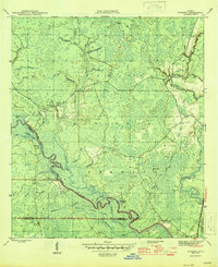
1945 Map of Sanborn
USGS Topo · Published 1945About this map
Apalachicola National Forest dominates this mid-1940s landscape, where the confluence of the Ochlockonee River and Wakulla River defines the southern terrain. This survey reveals a sparsely populated region of Wakulla and Liberty counties characterized by intricate swamp systems like Alligator Swamp and Womack Creek Swamp. The settlement of Sanborn serves as a focal point, featuring the Sanborn School, Sanborn Cemetery, and the Sanborn Lookout Tower.
Find a feature on this map
43 named features on this map. Tap any name to fly to it.
Don’t see what you’re looking for? This feature index may not catch every label — zoom into the map to look around manually.
Map Details
Editions of this 1945 Sanborn Map
3 editions found
Other maps of this area

1940 · Arran
USGS Topo · 1:62,500

1943 · Arran
USGS Topo · 1:62,500

1943 · St. Teresa Beach
USGS Topo · 1:24,000

1944 · Pickett Bay
USGS Topo · 1:31,680

1945 · Thousand Yard Bay
USGS Topo · 1:31,680

1945 · Smith Creek
USGS Topo · 1:31,680

1945 · Bradwell Bay
USGS Topo · 1:31,680

1945 · Mc Intyre
USGS Topo · 1:31,680

1945 · St Teresa
USGS Topo · 1:31,680

1945 · Pickett Bay
USGS Topo · 1:31,680