
1944 Map of Sugar Hill
USGS Topo · Published 1945About this map
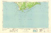
Sugar Hill rises above the narrow barrier landscape of St George Island in this coastal survey conducted during the final years of World War II. The map focuses on a slender segment of the Florida coast where the St George Sound meets the open Gulf of Mexico. The terrain is defined by shifting Sand and prominent Dunes, illustrating the natural state of the island before modern development transformed the region. A small pocket of Marsh and various unnamed tidal inlets highlight the fragile environment of the Apalachicola Bay area. This document was produced for the War Department by the Geological Survey, reflecting the strategic importance of coastal mapping during the 1940s.
Find a feature on this map
7 named features on this map. Tap any name to fly to it.
Don’t see what you’re looking for? This feature index may not catch every label — zoom into the map to look around manually.
Map Details
Editions of this 1944 Sugar Hill Map
This is the sole edition of this map. No revisions or reprints were ever made.
Other maps of this area

1943 · Dog Island
USGS Topo · 1:31,680

1943 · Carrabelle
USGS Topo · 1:24,000

1944 · Carrabelle
USGS Topo · 1:31,680

1944 · Green Point
USGS Topo · 1:31,680

1945 · Sugar Hill
USGS Topo · 1:31,680

1949 · Apalachicola
USGS Topo · 1:250,000

1950 · Goose Island
USGS Topo · 1:31,680

1957 · Apalachicola
USGS Topo · 1:250,000

1959 · Apalachicola
USGS Topo · 1:250,000
1960 · Apalachicola
USGS Topo · 1:250,000