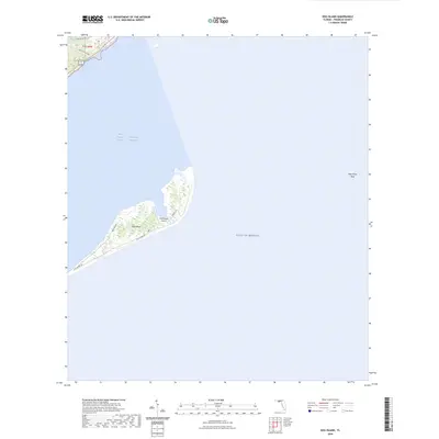
2024 Map of Dog Island
USGS Topo · Published 2024About this map
Dog Island stands as a barrier between the Gulf of Mexico and the Saint George Sound Intracoastal Waterway in Franklin County. This 2024 survey documents the island's narrow geography, where most development is concentrated on the southwestern end. The local infrastructure is oriented toward the coast, with routes like Gulf Shore Dr and Bayshore Dr skirting the shoreline, while the Dog Island Airport provides a critical transportation link for this isolated landmass. To the northeast, the terrain transitions into the submerged Dog Island Reef. On the mainland at the map's northern edge, a small residential grid appears around Lake Morality Rd and Kenneth B Cope Ave, highlighting the contrast between the developed coastal strip and the maritime expanse of the sound.
Find a feature on this map
11 named features on this map. Tap any name to fly to it.
Don’t see what you’re looking for? This feature index may not catch every label — zoom into the map to look around manually.
Map Details
Editions of this 2024 Dog Island Map
This is the sole edition of this map. No revisions or reprints were ever made.
Other maps of this area

1943 · Dog Island
USGS Topo · 1:31,680

1943 · Carrabelle
USGS Topo · 1:24,000

1943 · St. Teresa Beach
USGS Topo · 1:24,000

1944 · Pickett Bay
USGS Topo · 1:31,680

1944 · Carrabelle
USGS Topo · 1:31,680

1944 · Sugar Hill
USGS Topo · 1:31,680

1945 · Mc Intyre
USGS Topo · 1:31,680

1945 · Sugar Hill
USGS Topo · 1:31,680

1945 · St Teresa
USGS Topo · 1:31,680

1945 · Pickett Bay
USGS Topo · 1:31,680