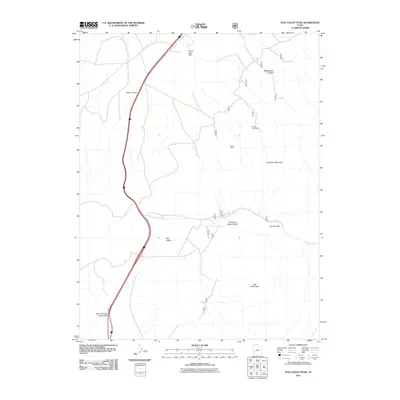
2011 Map of Dog Valley Peak
USGS Topo · Published 2011About this map
Dog Valley Peak and the surrounding high country of Millard County are defined by a complex network of canyons and gulches in this 2011 topographic study. The landscape shows a clear history of resource extraction, with the Jewkes Mine and Purple Sage Mine situated on the eastern slopes of Dog Valley Mountain. To the west, the modern corridor of Interstate 15 cuts through the terrain, passing through the Cove Fort Dog Valley Pass and alongside Baker Canyon. The drainage patterns of the area are dominated by Dog Valley Creek, which winds through The Narrows and Thousand Dollar Gulch before meeting Cove Creek in the south. This map provides a detailed look at the geographic features of Dog Valley and the expansive White Sage Flat to the north.
Find a feature on this map
14 named features on this map. Tap any name to fly to it.
Don’t see what you’re looking for? This feature index may not catch every label — zoom into the map to look around manually.
Map Details
Editions of this 2011 Dog Valley Peak Map
This is the sole edition of this map. No revisions or reprints were ever made.
Other maps of this area

1885 · Beaver
USGS Topo · 1:250,000

1932 · Sevier
USGS Topo · 1:62,500

1935 · Sevier
USGS Topo · 1:62,500

1953 · Richfield
USGS Topo · 1:250,000

1958 · Richfield
USGS Topo · 1:250,000

1962 · Fillmore
USGS Topo · 1:62,500

1962 · Tabernacle Hill
USGS Topo · 1:62,500

1962 · Cove Fort
USGS Topo · 1:62,500

1980 · Richfield
USGS Topo · 1:100,000
1981 · Red Ridge
USGS Topo · 1:24,000