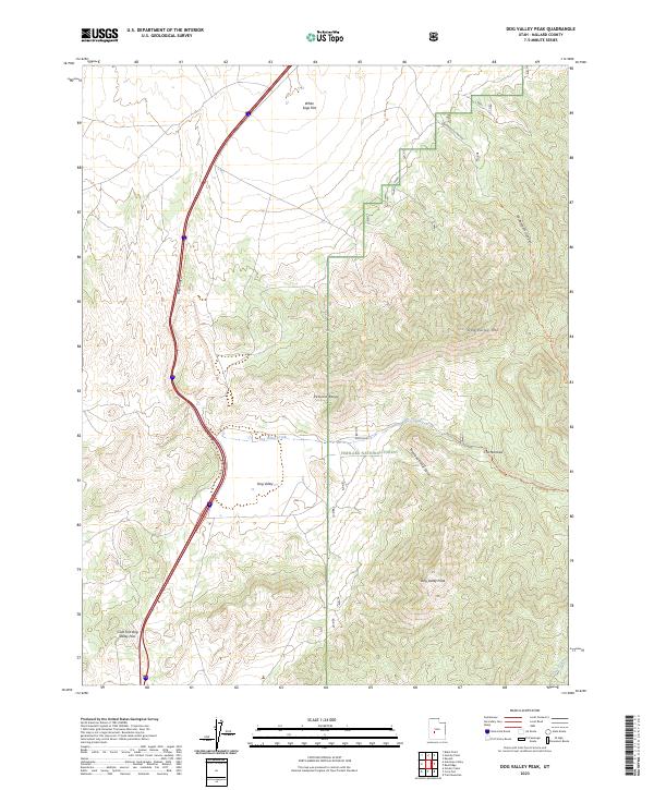
2023 Map of Dog Valley Peak
USGS Topo · Published 2023About this map
The Pahvant Range dominates this portion of Millard County, defining a landscape of high ridges and deep drainages within the Fishlake National Forest. The topography is marked by significant elevation changes, from the broad expanse of White Sage Flat in the north to the prominence of Dog Valley Peak in the south. Transportation through this mountain terrain is funneled through natural corridors such as Baker Canyon and the Cove Fort Dog Valley Pass, tracing paths that have long connected these high valleys. Water is a scarce but critical element, represented by the seasonal flows of Dog Valley Creek and Cove Creek. The map also details a network of historic tracks and routes, including the Wide Mouth Trl and the Dog Valley - Bull Valley Trl, which navigate the steep geography of Dog Valley Mtn and Widemouth Canyon.
Find a feature on this map
18 named features on this map. Tap any name to fly to it.
Don’t see what you’re looking for? This feature index may not catch every label — zoom into the map to look around manually.
Map Details
Editions of this 2023 Dog Valley Peak Map
This is the sole edition of this map. No revisions or reprints were ever made.
Other maps of this area

1885 · Beaver
USGS Topo · 1:250,000

1932 · Sevier
USGS Topo · 1:62,500

1935 · Sevier
USGS Topo · 1:62,500

1953 · Richfield
USGS Topo · 1:250,000

1958 · Richfield
USGS Topo · 1:250,000

1962 · Fillmore
USGS Topo · 1:62,500

1962 · Tabernacle Hill
USGS Topo · 1:62,500

1962 · Cove Fort
USGS Topo · 1:62,500

1980 · Richfield
USGS Topo · 1:100,000
1981 · Red Ridge
USGS Topo · 1:24,000