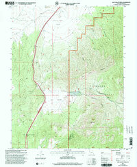
2001 Map of Dog Valley Peak
USGS Topo · Published 2003About this map
White Sage Flat dominates the northern reaches of this high-altitude landscape, where the open terrain gives way to the complex topography of Fishlake National Forest. The map documents a rugged interior of Millard County, punctuated by Dog Valley Peak and the important transit corridor through Cove Fort-Dog Valley Pass. This area, while largely undeveloped, shows a legacy of small-scale resource extraction with several Prospects, a Mine Shaft, and an Open Pit Mine located in the southern sections.
Find a feature on this map
25 named features on this map. Tap any name to fly to it.
Don’t see what you’re looking for? This feature index may not catch every label — zoom into the map to look around manually.
Map Details
Editions of this 2001 Dog Valley Peak Map
This is the sole edition of this map. No revisions or reprints were ever made.
Other maps of this area

1885 · Beaver
USGS Topo · 1:250,000

1932 · Sevier
USGS Topo · 1:62,500

1935 · Sevier
USGS Topo · 1:62,500

1953 · Richfield
USGS Topo · 1:250,000

1958 · Richfield
USGS Topo · 1:250,000

1962 · Fillmore
USGS Topo · 1:62,500

1962 · Tabernacle Hill
USGS Topo · 1:62,500

1962 · Cove Fort
USGS Topo · 1:62,500

1980 · Richfield
USGS Topo · 1:100,000
1981 · Red Ridge
USGS Topo · 1:24,000