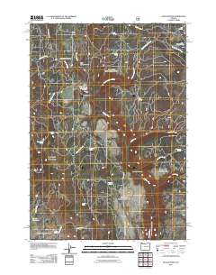
2011 Map of Dollar Basin
USGS Topo · Published 2011About this map
The Malheur River winds through this high-desert landscape in Harney County, serving as the central artery for a region defined by its seasonal water sources and broad plateaus. Access to the backcountry is anchored by the Malheur River Trailhead and the Malheur Ford, marking traditional crossing points in a terrain of deep canyons and flats. The names across the sheet, such as Diamond Dot Gulch and Dollar Basin, reflect the ranching and land-use heritage of this portion of Oregon. Numerous springs, including Yellowjacket Spring, Wade Spring, and Blinn Spring, indicate the vital locations where water was once sought for livestock and travel. Moving south, the topography transitions toward Hog Flat and the Lucky Reservoir, with Frost Mill Rd providing one of the few established routes through the southern reaches of the quadrangle.
Find a feature on this map
35 named features on this map. Tap any name to fly to it.
Don’t see what you’re looking for? This feature index may not catch every label — zoom into the map to look around manually.
Map Details
Editions of this 2011 Dollar Basin Map
This is the sole edition of this map. No revisions or reprints were ever made.
Other maps of this area

1908 · Ironside Mountain
USGS Topo · 1:125,000

1955 · Burns
USGS Topo · 1:250,000

1955 · Canyon City
USGS Topo · 1:250,000

1958 · Burns
USGS Topo · 1:250,000

1959 · Burns
USGS Topo · 1:250,000

1959 · Canyon City
USGS Topo · 1:250,000

1961 · Logan Valley
USGS Topo · 1:62,500

1968 · Drewsey
USGS Topo · 1:62,500

1968 · Van
USGS Topo · 1:62,500

1970 · Flag Prairie
USGS Topo · 1:62,500