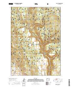
2020 Map of Dollar Basin
USGS Topo · Published 2020About this map
Malheur National Forest dominates this section of the Oregon high country, where the landscape is defined by the canyon systems of the Malheur Wild and Scenic River. The map reveals a complex network of topographical features named by early ranchers and surveyors, including Diamond Dot Gulch, Van Gulch, and Lake Camp Gulch. These water-carved features descend from higher elevations like Dollar Basin and Miller Flat toward the river's path. Numerous water sources, such as McAllister Spring, Lake Camp Spring, and Yellowjacket Spring, are scattered throughout the forest, indicating the essential role of localized water points in this arid environment. The transition between Grant and Harney counties cuts across the rugged terrain, marking political boundaries in a wilderness primarily utilized for resource management and conservation. The density of named springs and flats suggests a history of livestock grazing and backcountry navigation long before the area was designated for formal protection.
Find a feature on this map
48 named features on this map. Tap any name to fly to it.
Don’t see what you’re looking for? This feature index may not catch every label — zoom into the map to look around manually.
Map Details
Editions of this 2020 Dollar Basin Map
This is the sole edition of this map. No revisions or reprints were ever made.
Other maps of this area

1908 · Ironside Mountain
USGS Topo · 1:125,000

1955 · Burns
USGS Topo · 1:250,000

1955 · Canyon City
USGS Topo · 1:250,000

1958 · Burns
USGS Topo · 1:250,000

1959 · Burns
USGS Topo · 1:250,000

1959 · Canyon City
USGS Topo · 1:250,000

1961 · Logan Valley
USGS Topo · 1:62,500

1968 · Drewsey
USGS Topo · 1:62,500

1968 · Van
USGS Topo · 1:62,500

1970 · Flag Prairie
USGS Topo · 1:62,500