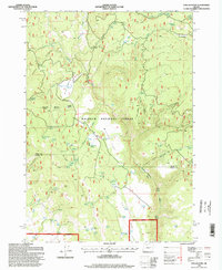
1996 Map of Dollar Basin
USGS Topo · Published 1998About this map
Malheur National Forest dominates this high-altitude landscape along the border of Grant and Harney counties. The terrain is defined by a complex network of seasonal drainages and springs that feed the upper reaches of the Malheur River, which winds through the southern portion of the quadrangle. Distinctive features like the wide Dollar Basin and the expansive Miller Flat illustrate the high plateau geography of the Blue Mountains, where water management is critical as evidenced by numerous Stock Ponds and named water sources like Mike Acton Spring and Tureman Spring.
Find a feature on this map
56 named features on this map. Tap any name to fly to it.
Don’t see what you’re looking for? This feature index may not catch every label — zoom into the map to look around manually.
Map Details
Editions of this 1996 Dollar Basin Map
This is the sole edition of this map. No revisions or reprints were ever made.
Other maps of this area

1908 · Ironside Mountain
USGS Topo · 1:125,000

1955 · Burns
USGS Topo · 1:250,000

1955 · Canyon City
USGS Topo · 1:250,000

1958 · Burns
USGS Topo · 1:250,000

1959 · Burns
USGS Topo · 1:250,000

1959 · Canyon City
USGS Topo · 1:250,000

1961 · Logan Valley
USGS Topo · 1:62,500

1968 · Drewsey
USGS Topo · 1:62,500

1968 · Van
USGS Topo · 1:62,500

1970 · Flag Prairie
USGS Topo · 1:62,500