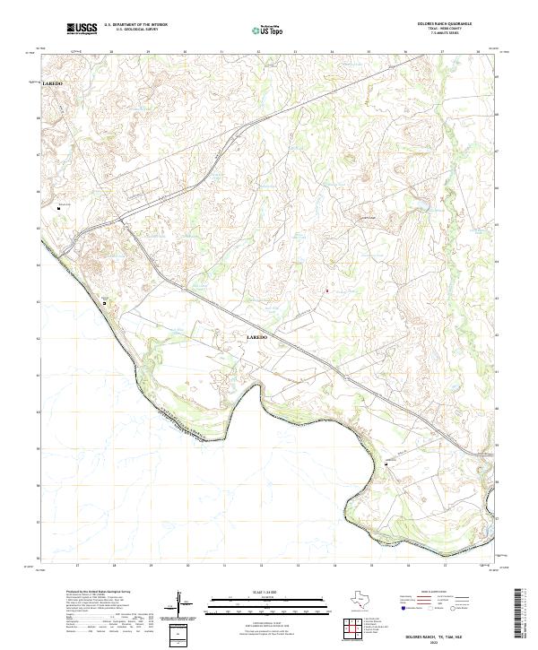
2022 Map of Dolores Ranch
USGS Topo · Published 2022About this map
The Rio Grande serves as the international boundary between the United States and Mexico, carving a winding path along the southern edge of this Webb County landscape. Inland, the terrain is defined by a dense network of intermittent creeks and livestock tanks, essential features for ranching in this arid region. Named water sources like Sandia Tank, Escondido Tank, and Anita Tank are scattered across the brushland, supporting a way of life oriented around the water availability in the valleys of Pinto Valle Cr and Los Indios Cr.
Find a feature on this map
36 named features on this map. Tap any name to fly to it.
Don’t see what you’re looking for? This feature index may not catch every label — zoom into the map to look around manually.
Map Details
Editions of this 2022 Dolores Ranch Map
This is the sole edition of this map. No revisions or reprints were ever made.
Other maps of this area

1923 · Palafox
USGS Topo · 1:62,500

1956 · Las Tiendas
USGS Topo · 1:62,500

1956 · Islitas
USGS Topo · 1:62,500

1956 · Laredo
USGS Topo · 1:250,000

1965 · Laredo West
USGS Topo · 1:24,000

1965 · Cuervo Creek
USGS Topo · 1:24,000

1965 · Cerritos Blancos
USGS Topo · 1:24,000

1965 · Nido Ranch
USGS Topo · 1:24,000
1965 · Dolores Ranch
USGS Topo · 1:24,000
1983 · San Pedro Hill
USGS Topo · 1:24,000