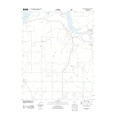
2011 Map of Dolores West
USGS Topo · Published 2011About this map
The settlement of Lebanon and the western edge of Dolores anchor this landscape in Montezuma County, defined by an intricate network of irrigation systems and expansive reservoirs. Water management is the dominant architectural force here, seen in the Lone Pine Lateral, Upper Hermana Lateral, and the Rocky Ford Ditch which crisscross the plains between the Narraguinnep Reservoir and the massive McPhee Reservoir. These engineering works transformed the high desert terrain, supporting the agricultural communities established along the grid of county roads.
Find a feature on this map
70 named features on this map. Tap any name to fly to it.
Don’t see what you’re looking for? This feature index may not catch every label — zoom into the map to look around manually.
Map Details
Editions of this 2011 Dolores West Map
This is the sole edition of this map. No revisions or reprints were ever made.
Other maps of this area

1956 · Cortez
USGS Topo · 1:250,000

1958 · Cortez SW
USGS Topo · 1:24,000

1958 · Cortez
USGS Topo · 1:250,000

1959 · Cortez
USGS Topo · 1:250,000

1962 · Cortez
USGS Topo · 1:250,000

1965 · Cortez
USGS Topo · 1:24,000

1965 · Dolores East
USGS Topo · 1:24,000

1965 · Dolores West
USGS Topo · 1:24,000

1965 · Yellow Jacket
USGS Topo · 1:24,000
1965 · Arriola
USGS Topo · 1:24,000