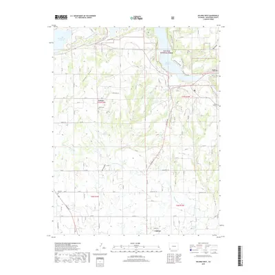
2019 Map of Dolores West
USGS Topo · Published 2019About this map
The San Juan National Forest meets an intricate network of agricultural irrigation in this high-desert landscape near the edge of Cortez. Water management is the defining characteristic of the region, visible through the expansive McPhee Reservoir and Narraguinnep Reservoir, which feed a complex system of man-made waterways including the Main Canal Number 1, Highline Ditch, and Upper Hermana Lateral. This infrastructure supports the small settlements of Lebanon and Dolores, where local history is anchored by sites like the Lebanon Cem and Summit Ridge Cem. The terrain is deeply incised by several natural drainages such as May Canyon and Leavell Draw, while the Dolores River continues its course in the northeast. This 2019 survey captures a landscape where modern engineering and old pioneer-era cemeteries coexist among the mesas.
Find a feature on this map
101 named features on this map. Tap any name to fly to it.
Don’t see what you’re looking for? This feature index may not catch every label — zoom into the map to look around manually.
Map Details
Editions of this 2019 Dolores West Map
This is the sole edition of this map. No revisions or reprints were ever made.
Other maps of this area

1956 · Cortez
USGS Topo · 1:250,000

1958 · Cortez SW
USGS Topo · 1:24,000

1958 · Cortez
USGS Topo · 1:250,000

1959 · Cortez
USGS Topo · 1:250,000

1962 · Cortez
USGS Topo · 1:250,000

1965 · Cortez
USGS Topo · 1:24,000

1965 · Dolores East
USGS Topo · 1:24,000

1965 · Dolores West
USGS Topo · 1:24,000

1965 · Yellow Jacket
USGS Topo · 1:24,000
1965 · Arriola
USGS Topo · 1:24,000