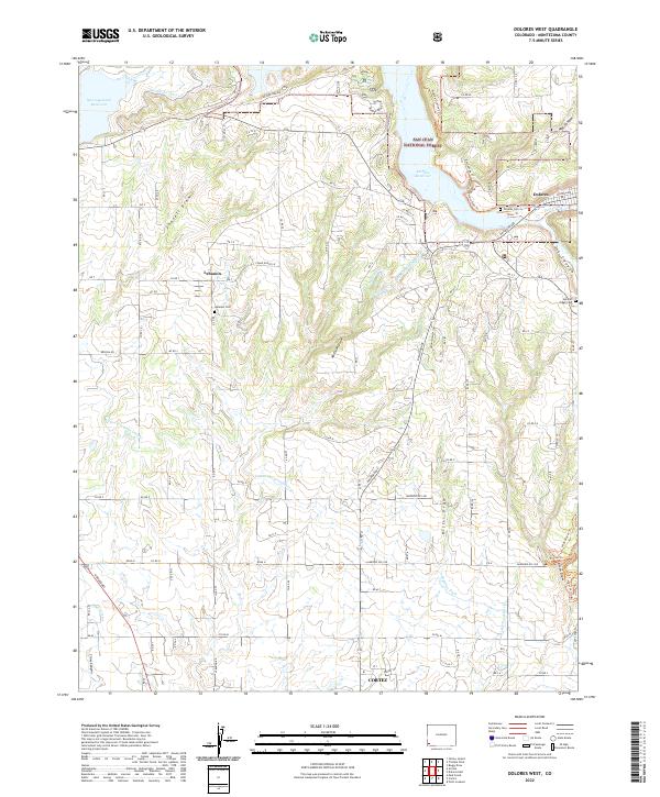
2022 Map of Dolores West
USGS Topo · Published 2022About this map
The Dolores River valley and the high desert plateaus of Montezuma County are defined by a complex network of irrigation infrastructure designed to sustain agricultural life. Extensive water systems such as the Main Canal Number 1, Highline Ditch, and Upper Hermana Lateral dominate the landscape, gravity-feeding water from the McPhee Reservoir and Narraguinnep Reservoir to the surrounding farms. This modern survey illustrates the proximity of the northern outskirts of Cortez to the historic settlement at Lebanon, showing how rural road grids have expanded around traditional land boundaries.
Find a feature on this map
104 named features on this map. Tap any name to fly to it.
Don’t see what you’re looking for? This feature index may not catch every label — zoom into the map to look around manually.
Map Details
Editions of this 2022 Dolores West Map
This is the sole edition of this map. No revisions or reprints were ever made.
Other maps of this area

1956 · Cortez
USGS Topo · 1:250,000

1958 · Cortez SW
USGS Topo · 1:24,000

1958 · Cortez
USGS Topo · 1:250,000

1959 · Cortez
USGS Topo · 1:250,000

1962 · Cortez
USGS Topo · 1:250,000

1965 · Cortez
USGS Topo · 1:24,000

1965 · Dolores East
USGS Topo · 1:24,000

1965 · Dolores West
USGS Topo · 1:24,000

1965 · Yellow Jacket
USGS Topo · 1:24,000
1965 · Arriola
USGS Topo · 1:24,000