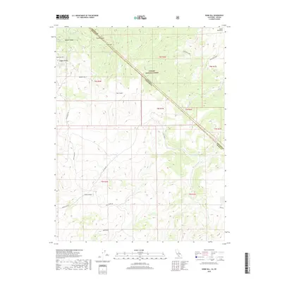
2018 Map of Dome Hill
USGS Topo · Published 2018About this map
Upper Town and Lower Town sit at the northwest corner of this high-altitude landscape, where the Bodie Mountains meet the Toiyabe National Forest. The map documents a rugged transition across the Nevada California state line, with the Mineral Co and Mono Co boundary slicing through the northeastern quadrant. Water is a precious resource in this arid terrain, marked by isolated points like Masonic Spring and Burnt Hill Spring.
Find a feature on this map
26 named features on this map. Tap any name to fly to it.
Don’t see what you’re looking for? This feature index may not catch every label — zoom into the map to look around manually.
Map Details
Editions of this 2018 Dome Hill Map
This is the sole edition of this map. No revisions or reprints were ever made.
Other maps of this area

1909 · Hawthorne
USGS Topo · 1:250,000

1909 · Bridgeport
USGS Topo · 1:125,000

1911 · Bridgeport
USGS Topo · 1:125,000

1911 · Hawthorne
USGS Topo · 1:250,000

1915 · Hawthorne
USGS Topo · 1:250,000

1920 · Bridgeport
USGS Topo · 1:125,000

1948 · Walker Lake
USGS Topo · 1:250,000

1956 · Aurora
USGS Topo · 1:62,500

1957 · Walker Lake
USGS Topo · 1:250,000

1958 · Bodie
USGS Topo · 1:62,500