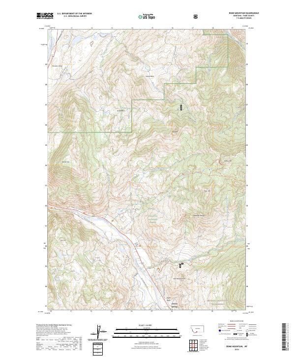
2024 Map of Dome Mountain
USGS Topo · Published 2024About this map
Yellowstone River currents carve through the dramatic geography of Paradise Valley, serving as the central artery for this mountainous region of Park County. The 2024 landscape is defined by the steep elevation changes of the Absaroka Range, where named peaks like Dome Mtn and Sphinx Mtn overlook the tight passage of Yankee Jim Canyon. Human imprints are concentrated along the river corridor, notably at Corwin Springs and the striking Rigler Bluffs. This modern survey details the vital transportation routes that follow the river's path, including the Old Yellowstone Trl S and Hideaway road. Much of the eastern and central terrain is protected within the Gallatin National Forest and the Absaroka-Beartooth Wilderness, preserving the drainage networks of Sheep Creek and Cedar Creek which flow from high basins toward the valley floor.
Find a feature on this map
45 named features on this map. Tap any name to fly to it.
Don’t see what you’re looking for? This feature index may not catch every label — zoom into the map to look around manually.
Map Details
Editions of this 2024 Dome Mountain Map
This is the sole edition of this map. No revisions or reprints were ever made.
Other maps of this area

1891 · Livingston
USGS Topo · 1:250,000

1893 · Livingston
USGS Topo · 1:250,000

1947 · Bozeman
USGS Topo · 1:250,000

1948 · Bozeman
USGS Topo · 1:250,000

1955 · Bozeman
USGS Topo · 1:250,000

1955 · Emigrant
USGS Topo · 1:62,500

1955 · Fridley Peak
USGS Topo · 1:62,500
1955 · Gardiner
USGS Topo · 1:62,500
1955 · Miner
USGS Topo · 1:62,500

1958 · Bozeman
USGS Topo · 1:250,000