
1940 Map of Dome Rock Mts
USGS Topo · Published 1940About this map
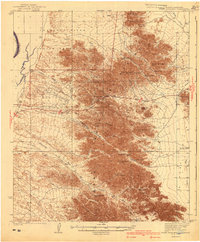
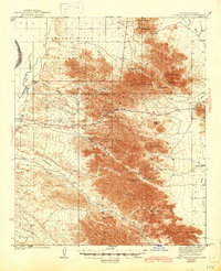
Mining operations and rugged desert topography define this 1933 survey of the Arizona-California borderlands. The Dome Rock Mountains dominate the center of the sheet, where a network of prospector sites like the Copper Bottom Mine, Cinnabar Mine, and Colvic Mine underscore the region's hard-rock extraction history. To the west, the Colorado River serves as the dividing line between Riverside County, California and Yuma County, Arizona, with the Colorado River Indian Reservation Boundary cutting across the mountain flanks. The map illustrates a desert drainage system where dry beds like Seventy Mile Wash and Goodman Wash lead toward the river valley. Key transit routes through the massif are documented via Diablo Pass and Marquetta Pass, revealing how travelers and miners navigated this arid landscape before modern infrastructure.
Find a feature on this map
35 named features on this map. Tap any name to fly to it.
Don’t see what you’re looking for? This feature index may not catch every label — zoom into the map to look around manually.
Map Details
Editions of this 1940 Dome Rock Mts Map
3 editions found
Other maps of this area

1930 · Linskey
USGS Topo · 1:62,500

1931 · Moon Mtn
USGS Topo · 1:62,500

1932 · Moon Mtn
USGS Topo · 1:62,500

1933 · Cunningham Mtn
USGS Topo · 1:48,000

1934 · Trigo Peaks
USGS Topo · 1:48,000

1939 · Trigo Peaks
USGS Topo · 1:62,500

1942 · Blythe
USGS Topo · 1:250,000

1942 · MOON MTN
USGS Topo · 1:62,500

1945 · Big Maria Mtns
USGS Topo · 1:62,500

1945 · Cibola
USGS Topo · 1:62,500