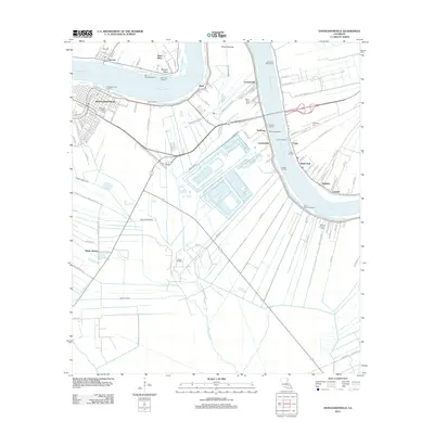
2012 Map of Donaldsonville
USGS Topo · Published 2012About this map
Donaldsonville serves as the focal point of this riverfront landscape, where the Mississippi River carves a deep bend around Bringier Point and Point Houmas. The town's historic street grid is preserved alongside the Ascension Catholic Cem, while the surrounding parish landscape is defined by its relationship with the water and industrial development. Numerous landing sites, such as Hermitage Landing and Stella Landing, line the riverbanks, marking a long history of maritime commerce and transport.
Find a feature on this map
110 named features on this map. Tap any name to fly to it.
Don’t see what you’re looking for? This feature index may not catch every label — zoom into the map to look around manually.
Map Details
Editions of this 2012 Donaldsonville Map
This is the sole edition of this map. No revisions or reprints were ever made.
Other maps of this area

1892 · Donaldsonville
USGS Topo · 1:62,500

1892 · Thibodaux
USGS Topo · 1:62,500

1927 · Thibodaux NW
USGS Topo · 1:31,680

1932 · Thibodaux NE
USGS Topo · 1:31,680

1935 · Gonzales
USGS Topo · 1:31,680

1936 · White Castle
USGS Topo · 1:62,500

1939 · Donaldsonville
USGS Topo · 1:62,500

1940 · Lagan
USGS Topo · 1:31,680

1940 · Madewood
USGS Topo · 1:31,680

1945 · New Orleans
USGS Topo · 1:250,000