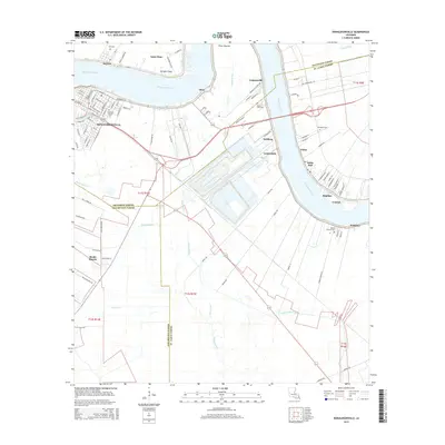
2015 Map of Donaldsonville
USGS Topo · Published 2015About this map
Mississippi River bends sharply at Bringier Point and Point Houmas, defining the geography of this three-parish border region. The city of Donaldsonville sits at the head of Bayou Lafourche, its grid of streets such as Houmas St and St Patrick St reflecting its status as a riverfront hub. The landscape is marked by historical plantation-era settlements like Lemannville, Salsburg, Lauderdale, and Union that follow the natural levees of the river. Genealogists can find several established burial grounds, including the Ascension Catholic Cem in the city and rural sites like Philippian Cem and Mount Calvary Cem. To the south and west, the terrain transitions into a complex drainage network featuring Bayou Napoleon, Bayou Verret, and the Seatra Canal, illustrating the sophisticated water management required in this low-lying coastal environment.
Find a feature on this map
106 named features on this map. Tap any name to fly to it.
Don’t see what you’re looking for? This feature index may not catch every label — zoom into the map to look around manually.
Map Details
Editions of this 2015 Donaldsonville Map
This is the sole edition of this map. No revisions or reprints were ever made.
Other maps of this area

1892 · Donaldsonville
USGS Topo · 1:62,500

1892 · Thibodaux
USGS Topo · 1:62,500

1927 · Thibodaux NW
USGS Topo · 1:31,680

1932 · Thibodaux NE
USGS Topo · 1:31,680

1935 · Gonzales
USGS Topo · 1:31,680

1936 · White Castle
USGS Topo · 1:62,500

1939 · Donaldsonville
USGS Topo · 1:62,500

1940 · Lagan
USGS Topo · 1:31,680

1940 · Madewood
USGS Topo · 1:31,680

1945 · New Orleans
USGS Topo · 1:250,000