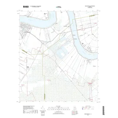
2018 Map of Donaldsonville
USGS Topo · Published 2018About this map
The Mississippi River winds through this Ascension Parish landscape, defining the historic distribution of long-lot land tracts that reach back from the riverbanks. The city of Donaldsonville serves as the focal point, where the river meets the diverging waters of Bayou Napoleon. This geography illustrates the classic Louisiana river settlement pattern, with communities like Darrow, Lemannville, and Salsburg lining the natural levees. The interior lowlands are defined by extensive wetlands and drainage systems such as Bayou Verret and the Saint James Canal. Genealogists will find a high density of burial sites across the river bends, including Ascension Catholic Cem and Buena Vista Cem, alongside smaller family or church-affiliated plots like Philippian Cem and Ebenezer Cem near Saint Elmo. The prominence of named points like Point Houmas and Bringier Point highlights the river's navigational importance in this era.
Find a feature on this map
106 named features on this map. Tap any name to fly to it.
Don’t see what you’re looking for? This feature index may not catch every label — zoom into the map to look around manually.
Map Details
Editions of this 2018 Donaldsonville Map
This is the sole edition of this map. No revisions or reprints were ever made.
Other maps of this area

1892 · Donaldsonville
USGS Topo · 1:62,500

1892 · Thibodaux
USGS Topo · 1:62,500

1927 · Thibodaux NW
USGS Topo · 1:31,680

1932 · Thibodaux NE
USGS Topo · 1:31,680

1935 · Gonzales
USGS Topo · 1:31,680

1936 · White Castle
USGS Topo · 1:62,500

1939 · Donaldsonville
USGS Topo · 1:62,500

1940 · Lagan
USGS Topo · 1:31,680

1940 · Madewood
USGS Topo · 1:31,680

1945 · New Orleans
USGS Topo · 1:250,000