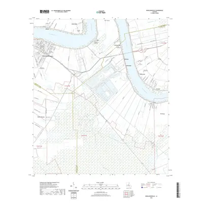
2020 Map of Donaldsonville
USGS Topo · Published 2020About this map
The Mississippi River winds through this Ascension Parish landscape, anchoring a series of riverfront settlements and agricultural stretches. In the historic city of Donaldsonville, the Ascension Parish Courthouse Donaldsonville stands near the riverbank, surrounded by a dense network of streets like Mississippi St and Railroad Ave. This area is particularly rich in genealogical data, preserving the locations of numerous burial grounds such as the Ascension of Our Lord Catholic Cem, Bikur Sholim Cem, and Pearly Gate Memorial Park.
Find a feature on this map
102 named features on this map. Tap any name to fly to it.
Don’t see what you’re looking for? This feature index may not catch every label — zoom into the map to look around manually.
Map Details
Editions of this 2020 Donaldsonville Map
This is the sole edition of this map. No revisions or reprints were ever made.
Other maps of this area

1892 · Donaldsonville
USGS Topo · 1:62,500

1892 · Thibodaux
USGS Topo · 1:62,500

1927 · Thibodaux NW
USGS Topo · 1:31,680

1932 · Thibodaux NE
USGS Topo · 1:31,680

1935 · Gonzales
USGS Topo · 1:31,680

1936 · White Castle
USGS Topo · 1:62,500

1939 · Donaldsonville
USGS Topo · 1:62,500

1940 · Lagan
USGS Topo · 1:31,680

1940 · Madewood
USGS Topo · 1:31,680

1945 · New Orleans
USGS Topo · 1:250,000