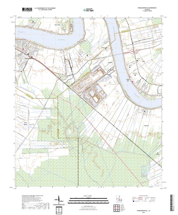
2024 Map of Donaldsonville
USGS Topo · Published 2024About this map
Donaldsonville serves as the focal point of this riverine survey, where the Mississippi River takes a sharp bend near Bringier Point and Point Houmas. The town's grid is dense with civic and religious history, anchored by the Ascension Parish Courthouse and several denominational burial grounds including Protestant Cem, Bikur Sholim Cem, and the Ascension of Our Lord Catholic Cem. Across the river and downstream, the landscape transitions into a pattern of historic settlements like Union, Welcome, and Lauderdale, often organized along the primary corridors of River Rd. Extensive wetlands and drainage networks such as the Seatra Canal, Saint James Canal, and Bayou Verret define the interior land use, illustrating the complex relationship between the agricultural stretches of the river parishes and the low-lying basins that surround them. Small riverside communities like Aben and Lemannyville further mark the transit routes along the levee system.
Find a feature on this map
117 named features on this map. Tap any name to fly to it.
Don’t see what you’re looking for? This feature index may not catch every label — zoom into the map to look around manually.
Map Details
Editions of this 2024 Donaldsonville Map
This is the sole edition of this map. No revisions or reprints were ever made.
Other maps of this area

1892 · Donaldsonville
USGS Topo · 1:62,500

1892 · Thibodaux
USGS Topo · 1:62,500

1927 · Thibodaux NW
USGS Topo · 1:31,680

1932 · Thibodaux NE
USGS Topo · 1:31,680

1935 · Gonzales
USGS Topo · 1:31,680

1936 · White Castle
USGS Topo · 1:62,500

1939 · Donaldsonville
USGS Topo · 1:62,500

1940 · Lagan
USGS Topo · 1:31,680

1940 · Madewood
USGS Topo · 1:31,680

1945 · New Orleans
USGS Topo · 1:250,000