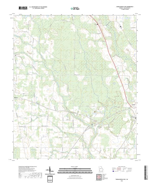
2024 Map of Donalsonville NE
USGS Topo · Published 2024About this map
Colquitt serves as a primary hub in this corner of Miller County, situated at the intersection of several significant regional thoroughfares. The landscape is defined by its intricate drainage network, with Spring Creek, Aycocks Creek, and Cypress Creek carving through the agricultural terrain. For those investigating local heritage, the map identifies numerous family and community landmarks, including the Newberry Family Cem, Roberts Cem, and the Pleasant Hill Free Will Baptist Church Cem. A notable land use feature is the large tract designated as the Farm Service Agency Interest of Georgia, which occupies a significant portion of the western territory. The distribution of smaller settlements like Mayhaw and the density of rural road names such as Wallace Newberry Rd and Grimsley Bridge Rd reflect a landscape shaped by generational family holdings and a long-standing agricultural economy.
Find a feature on this map
66 named features on this map. Tap any name to fly to it.
Don’t see what you’re looking for? This feature index may not catch every label — zoom into the map to look around manually.
Map Details
Editions of this 2024 Donalsonville NE Map
This is the sole edition of this map. No revisions or reprints were ever made.
Other maps of this area

1953 · Dothan
USGS Topo · 1:250,000

1954 · Dothan
USGS Topo · 1:250,000

1955 · Dothan
USGS Topo · 1:250,000

1973 · Blakely South
USGS Topo · 1:24,000

1973 · Hentown
USGS Topo · 1:24,000

1974 · Boykin
USGS Topo · 1:24,000

1974 · Donalsonville NE
USGS Topo · 1:24,000

1974 · Damascus
USGS Topo · 1:24,000
1974 · Donalsonville East
USGS Topo · 1:24,000
1974 · Colquitt
USGS Topo · 1:24,000