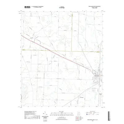
2020 Map of Donalsonville West
USGS Topo · Published 2020About this map
Donalsonville serves as the focal point of this Southwest Georgia landscape, where the Seminole County Courthouse stands at the center of the local grid. The area is defined by a transition from the structured street plan of the county seat to the sprawling agricultural tracts of Jakin and the community of Little Hope. Local genealogy is anchored by landmarks like Hodges Cem and Oak Cem, while the natural hydrology is marked by the Fishpond Drain and Byrd Pond. The transportation network reveals the importance of regional connectivity, featuring the Hugh D Broome Sr Pkwy and the Donalsonville Municipal Airport, alongside numerous family-named rural routes such as Dot Harvey Rd and Sapp Bridges Rd that weave through the wetlands and fields of the Early and Seminole County border.
Find a feature on this map
97 named features on this map. Tap any name to fly to it.
Don’t see what you’re looking for? This feature index may not catch every label — zoom into the map to look around manually.
Map Details
Editions of this 2020 Donalsonville West Map
This is the sole edition of this map. No revisions or reprints were ever made.
Other maps of this area

1952 · Bascom
USGS Topo · 1:24,000

1953 · Dothan
USGS Topo · 1:250,000

1954 · Dothan
USGS Topo · 1:250,000

1954 · Steam Mill
USGS Topo · 1:24,000

1954 · Desser
USGS Topo · 1:24,000

1954 · Tallahassee
USGS Topo · 1:250,000

1955 · Dothan
USGS Topo · 1:250,000

1959 · Tallahassee
USGS Topo · 1:250,000

1960 · Tallahassee
USGS Topo · 1:250,000

1970 · Gordon
USGS Topo · 1:24,000