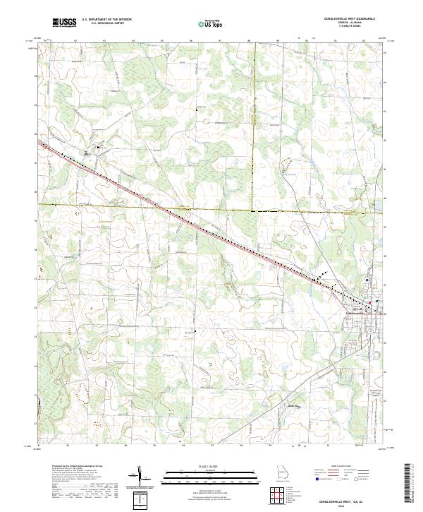
2024 Map of Donalsonville West
USGS Topo · Published 2024About this map
Donalsonville serves as the focal point of this Southwest Georgia landscape, where the Seminole County Courthouse stands at the heart of the local government. The town's layout and the presence of the Donalsonville Municipal Airport reflect its role as a regional hub. To the west, the smaller community of Jakin is situated along the major corridor of the Hugh D Broome Sr Pkwy, neighboring the local City Cem. The terrain is defined by a network of agricultural roads and seasonal water features like Fishpond Drain and Byrd Pond. Genealogists and local historians can trace family connections through sites like Hodges Cem and Oakview Cem, or explore the rural character of settlements such as Little Hope. This map illustrates the intersection of small-town infrastructure and the surrounding rural land use in the tri-county area of Seminole, Early, and Miller counties.
Find a feature on this map
59 named features on this map. Tap any name to fly to it.
Don’t see what you’re looking for? This feature index may not catch every label — zoom into the map to look around manually.
Map Details
Editions of this 2024 Donalsonville West Map
This is the sole edition of this map. No revisions or reprints were ever made.
Other maps of this area

1952 · Bascom
USGS Topo · 1:24,000

1953 · Dothan
USGS Topo · 1:250,000

1954 · Dothan
USGS Topo · 1:250,000

1954 · Steam Mill
USGS Topo · 1:24,000

1954 · Desser
USGS Topo · 1:24,000

1954 · Tallahassee
USGS Topo · 1:250,000

1955 · Dothan
USGS Topo · 1:250,000

1959 · Tallahassee
USGS Topo · 1:250,000

1960 · Tallahassee
USGS Topo · 1:250,000

1970 · Gordon
USGS Topo · 1:24,000