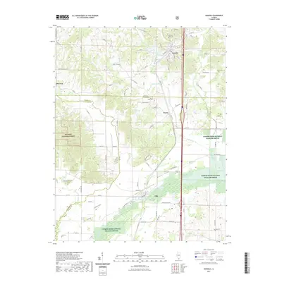
2021 Map of Dongola
USGS Topo · Published 2021About this map
Dongola and Ullin anchor this Southern Illinois landscape, positioned along the historic transport corridor of the Illinois Central Railroad. The terrain is defined by the transition from the upland ridges of the Shawnee National Forest to the low-lying wetlands of the Cypress Creek National Wildlife Refuge. Significant water bodies like the Cache River and Dongola Lake are central to the local geography, while elevated points such as Rattlesnake Hill and Mount Pisgah provide distinct landmarks among the winding country roads. Numerous rural burial grounds, including Butter Ridge Cem, American Legion Cem, and New Hope Cem, are scattered across the quadrangle, marking the long-standing community centers of Union and Pulaski counties.
Find a feature on this map
86 named features on this map. Tap any name to fly to it.
Don’t see what you’re looking for? This feature index may not catch every label — zoom into the map to look around manually.
Map Details
Editions of this 2021 Dongola Map
This is the sole edition of this map. No revisions or reprints were ever made.
Other maps of this area

1920 · Jonesboro
USGS Topo · 1:62,500

1920 · Dongola
USGS Topo · 1:62,500

1923 · Dongola
USGS Topo · 1:62,500

1923 · Jonesboro
USGS Topo · 1:62,500

1931 · Cairo
USGS Topo · 1:62,500

1933 · Cairo
USGS Topo · 1:62,500

1934 · Thebes
USGS Topo · 1:62,500

1939 · Cairo
USGS Topo · 1:62,500

1939 · Thebes
USGS Topo · 1:62,500

1947 · Jonesboro
USGS Topo · 1:62,500