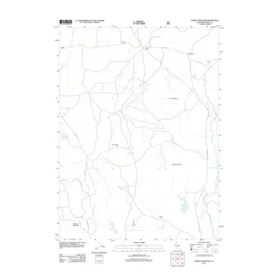
2012 Map of Donica Mountain
USGS Topo · Published 2012About this map
Lookout Junction serves as a geographic anchor for this Modoc County territory, where the landscape transitions through a series of significant mountain and water features. The Pit River winds through the eastern portion of the quadrangle, carving past Rose Canyon and beneath the eastern slopes of Donica Mountain. This area is defined by its water management and natural springs, from the remote Little Egg Lake to the engineered Upper Roberts Reservoir and Hines Reservoir. Natural hydrology is further represented by family-named landmarks like Armentrout Spring and Loudy Springs. Human activity is concentrated along the forest road network and at named locales such as Roberts Camp, reflecting the traditional ranching and timber heritage of this high-country region of Northern California.
Find a feature on this map
27 named features on this map. Tap any name to fly to it.
Don’t see what you’re looking for? This feature index may not catch every label — zoom into the map to look around manually.
Map Details
Editions of this 2012 Donica Mountain Map
This is the sole edition of this map. No revisions or reprints were ever made.
Other maps of this area

1886 · Modoc Lava Bed
USGS Topo · 1:250,000

1892 · Modoc Lava-Bed
USGS Topo · 1:250,000

1954 · Alturas
USGS Topo · 1:250,000

1958 · Alturas
USGS Topo · 1:250,000

1961 · Bieber
USGS Topo · 1:62,500

1961 · Fall River Mills
USGS Topo · 1:62,500

1962 · Alturas
USGS Topo · 1:250,000

1962 · Crank Mountain
USGS Topo · 1:62,500

1962 · White Horse
USGS Topo · 1:62,500

1965 · Alturas
USGS Topo · 1:250,000