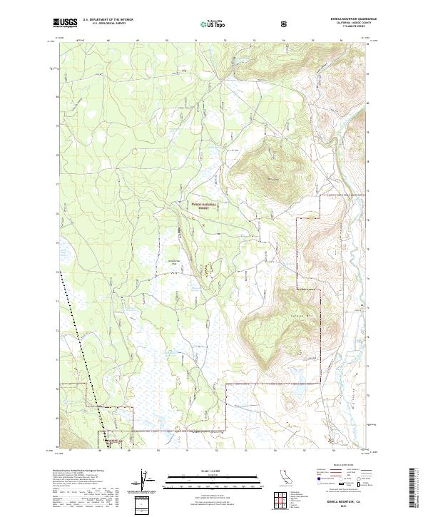
2021 Map of Donica Mountain
USGS Topo · Published 2021About this map
The Pit River winds through the eastern edge of this northern California landscape, which is largely defined by the protected acreage of the Modoc National Forest. This region of Modoc County is characterized by high-elevation water management and volcanic terrain, with several springs such as Crank Spring and Whalen Spring feeding into the local ecology. Significant man-made features include the Joiner Reservoir and Upper Roberts Reservoir, which capture runoff within the broad expanse of Armentrout Flat. To the east, the topography rises sharply at Donica Mountain and Splawn Mountain, overlooking the northwestern reaches of Big Valley. The area is interlaced with secondary roads and forest tracks, including Lookout Hackamore Rd and W Gouger Neck Rd, serving the timber and grazing lands of the high plateau.
Find a feature on this map
31 named features on this map. Tap any name to fly to it.
Don’t see what you’re looking for? This feature index may not catch every label — zoom into the map to look around manually.
Map Details
Editions of this 2021 Donica Mountain Map
This is the sole edition of this map. No revisions or reprints were ever made.
Other maps of this area

1886 · Modoc Lava Bed
USGS Topo · 1:250,000

1892 · Modoc Lava-Bed
USGS Topo · 1:250,000

1954 · Alturas
USGS Topo · 1:250,000

1958 · Alturas
USGS Topo · 1:250,000

1961 · Bieber
USGS Topo · 1:62,500

1961 · Fall River Mills
USGS Topo · 1:62,500

1962 · Alturas
USGS Topo · 1:250,000

1962 · Crank Mountain
USGS Topo · 1:62,500

1962 · White Horse
USGS Topo · 1:62,500

1965 · Alturas
USGS Topo · 1:250,000