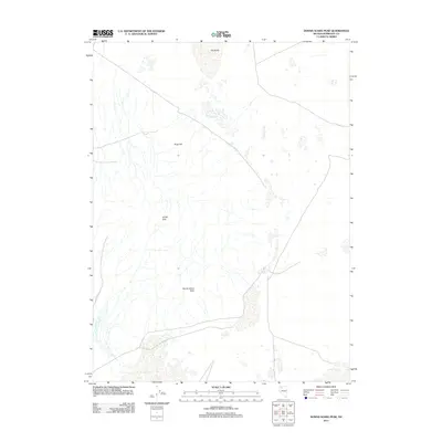
2011 Map of Donna Schee Peak
USGS Topo · Published 2011About this map
Donna Schee Peak serves as the namesake high point for this stretch of Humboldt County, marking a stark and arid landscape within the Great Basin. The terrain is defined by the elevation changes of the Jungo Hills and Krug Hill, contrasted against the flat, expansive surfaces of the northern Hardpans. These alkaline basins indicate a complex hydrological system where seasonal runoff collects and evaporates, leaving behind distinctive mineral crusts. This digital-era survey from the U.S. Geological Survey utilizes high-resolution imagery to document the intricate network of dry washes and desert tracks that weave through the northern Nevada wilderness.
Find a feature on this map
4 named features on this map. Tap any name to fly to it.
Don’t see what you’re looking for? This feature index may not catch every label — zoom into the map to look around manually.
Map Details
Editions of this 2011 Donna Schee Peak Map
This is the sole edition of this map. No revisions or reprints were ever made.
Other maps of this area

1886 · Disaster
USGS Topo · 1:250,000

1893 · Disaster
USGS Topo · 1:250,000

1931 · Lovelock
USGS Topo · 1:250,000

1935 · Lovelock
USGS Topo · 1:250,000

1954 · Vya
USGS Topo · 1:250,000

1955 · Lovelock
USGS Topo · 1:250,000

1958 · Vya
USGS Topo · 1:250,000

1959 · Lovelock
USGS Topo · 1:250,000

1962 · Vya
USGS Topo · 1:250,000
1966 · Donna Schee Peak
USGS Topo · 1:62,500