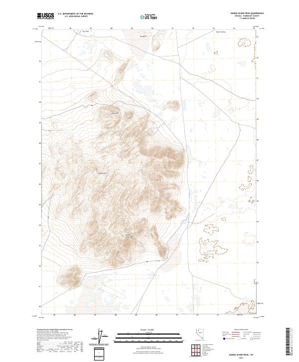
2021 Map of Donna Schee Peak
USGS Topo · Published 2021About this map
Donna Schee Peak stands as the central topographic focal point of this arid Great Basin landscape in Humboldt County. The terrain transitions from the rugged heights of the Jungo Hills and Krug Hill into the stark expanses of Desert Valley to the northeast. This 2021 survey documents the complex drainage patterns and natural catchment areas that characterize the region, including several large hardpans that collect seasonal runoff. The township and range boundaries, such as t37n r32e, underscore the systematic grid of the Public Land Survey System that governs this sparsely populated Nevada interior. The proximity of the Dry Hills to the northwest suggests a landscape shaped by significant elevation changes, where natural landmarks were essential for navigation and land management in a high-desert environment.
Find a feature on this map
12 named features on this map. Tap any name to fly to it.
Don’t see what you’re looking for? This feature index may not catch every label — zoom into the map to look around manually.
Map Details
Editions of this 2021 Donna Schee Peak Map
This is the sole edition of this map. No revisions or reprints were ever made.
Other maps of this area

1886 · Disaster
USGS Topo · 1:250,000

1893 · Disaster
USGS Topo · 1:250,000

1931 · Lovelock
USGS Topo · 1:250,000

1935 · Lovelock
USGS Topo · 1:250,000

1954 · Vya
USGS Topo · 1:250,000

1955 · Lovelock
USGS Topo · 1:250,000

1958 · Vya
USGS Topo · 1:250,000

1959 · Lovelock
USGS Topo · 1:250,000

1962 · Vya
USGS Topo · 1:250,000

1966 · Donna Schee Peak
USGS Topo · 1:62,500