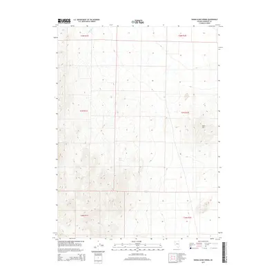
2015 Map of Donna Schee Spring
USGS Topo · Published 2015About this map
Donna Schee Spring and Noble Spring serve as critical water points in this arid stretch of Humboldt County, marking the sparse hydrography of the high desert. The terrain is defined by the Jungo Hills in the eastern portion of the quadrangle, with elevations rising above the surrounding basin. This modern 2015 survey reflects a landscape largely dominated by public lands and traditional township boundaries, including t37n r31e and t37n r32e. While the area remains sparsely settled, the presence of Shawnee Cr in the north suggests the seasonal drainage patterns typical of the Great Basin. This map is particularly useful for understanding the exact placement of named springs and topographical landmarks in a remote section of Nevada.
Find a feature on this map
10 named features on this map. Tap any name to fly to it.
Don’t see what you’re looking for? This feature index may not catch every label — zoom into the map to look around manually.
Map Details
Editions of this 2015 Donna Schee Spring Map
This is the sole edition of this map. No revisions or reprints were ever made.
Other maps of this area

1886 · Disaster
USGS Topo · 1:250,000

1893 · Disaster
USGS Topo · 1:250,000

1931 · Lovelock
USGS Topo · 1:250,000

1935 · Lovelock
USGS Topo · 1:250,000

1954 · Vya
USGS Topo · 1:250,000

1955 · Lovelock
USGS Topo · 1:250,000

1958 · Vya
USGS Topo · 1:250,000

1959 · Lovelock
USGS Topo · 1:250,000

1962 · Vya
USGS Topo · 1:250,000
1966 · Donna Schee Peak
USGS Topo · 1:62,500