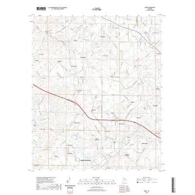
2020 Map of Dora
USGS Topo · Published 2020About this map
Dora and Sumiton anchor the northern landscape of this industrial and residential corridor, where the BNSF Ry and major roadways traverse the hills between the Mulberry Fork and the Locust Fork. The terrain is marked by a dense network of smaller settlements and mining-related locations, such as Bessie Junction, Flat Creek, and West Jefferson. The presence of the Miller Steam Plant Water Storage and the West Jefferson Reservoir highlights the regional infrastructure required for energy production and water management. Smaller communities like Twilley Town, Quinton, and Yerkwood are interconnected by winding county roads, while several historic burial grounds including Davis Cem and Bagley Bend Cem provide key points for genealogical research. The map illustrates how industry, power generation, and small-town Alabama life converge along these river forks.
Find a feature on this map
171 named features on this map. Tap any name to fly to it.
Don’t see what you’re looking for? This feature index may not catch every label — zoom into the map to look around manually.
Map Details
Editions of this 2020 Dora Map
This is the sole edition of this map. No revisions or reprints were ever made.
Other maps of this area

1889 · Birmingham
USGS Topo · 1:125,000

1892 · Birmingham
USGS Topo · 1:125,000

1893 · Jasper
USGS Topo · 1:125,000

1895 · Birmingham
USGS Topo · 1:125,000

1904 · Birmingham Coal District
USGS Topo · 1:62,500

1906 · Birmingham Special
USGS Topo · 1:62,500

1907 · Birmingham
USGS Topo · 1:125,000

1935 · Port Birmingham
USGS Topo · 1:48,000

1938 · Port Birmingham
USGS Topo · 1:62,500

1949 · Cordova
USGS Topo · 1:24,000