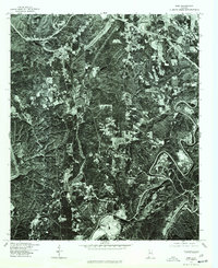
1975 Map of Dora
USGS Topo · Published 1977About this map
Dora serves as a primary reference point in this mid-1970s orthophoto, showing the tight-knit settlement patterns and transportation corridors of the Alabama coal country. Unlike traditional line maps, this photographic survey provides a direct view of the land use across Walker and Jefferson counties, revealing the physical footprint of Sumiton and West Jefferson. The imagery documents the dense vegetation of the regional terrain interspersed with cleared industrial or agricultural sites and winding river bends. By 1975, the area reflects a landscape defined by significant surface activity and modern road development, offering a distinct record of these communities just before the close of the twentieth century.
Find a feature on this map
3 named features on this map. Tap any name to fly to it.
Don’t see what you’re looking for? This feature index may not catch every label — zoom into the map to look around manually.
Map Details
Editions of this 1975 Dora Map
This is the sole edition of this map. No revisions or reprints were ever made.
Other maps of this area

1889 · Birmingham
USGS Topo · 1:125,000

1892 · Birmingham
USGS Topo · 1:125,000

1893 · Jasper
USGS Topo · 1:125,000

1895 · Birmingham
USGS Topo · 1:125,000

1904 · Birmingham Coal District
USGS Topo · 1:62,500

1906 · Birmingham Special
USGS Topo · 1:62,500

1907 · Birmingham
USGS Topo · 1:125,000

1935 · Port Birmingham
USGS Topo · 1:48,000

1938 · Port Birmingham
USGS Topo · 1:62,500

1949 · Cordova
USGS Topo · 1:24,000