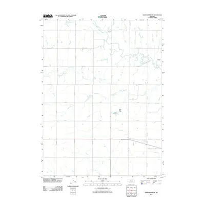
2011 Map of Dorchester NW
USGS Topo · Published 2011About this map
The West Fork Big Blue River meanders through this portion of Saline County, defining a landscape of agricultural sections and waterway corridors. Genealogists and local historians will find the Englehaupt Cemetery in the northern reaches and West Mills Cemetery to the east, markers of the early rural communities that established themselves along the river. The area's water management is anchored by the Weber Reservoir and the Weber Dam-1 Dam, which regulate the flow of Sand Creek. A network of section-line roads, including Denton Rd and Rokeby Rd, provides a precise grid for tracing historic land ownership and the paths of Johnson Creek and Otoe Creek across the Nebraska plains.
Find a feature on this map
23 named features on this map. Tap any name to fly to it.
Don’t see what you’re looking for? This feature index may not catch every label — zoom into the map to look around manually.
Map Details
Editions of this 2011 Dorchester NW Map
This is the sole edition of this map. No revisions or reprints were ever made.
Other maps of this area

1934 · Seward
USGS Topo · 1:48,000

1934 · Utica
USGS Topo · 1:62,500

1935 · Dorchester
USGS Topo · 1:48,000

1937 · Utica
USGS Topo · 1:62,500

1939 · Seward
USGS Topo · 1:62,500

1940 · Dorchester
USGS Topo · 1:62,500

1955 · Lincoln
USGS Topo · 1:250,000

1957 · Lincoln
USGS Topo · 1:250,000

1958 · Lincoln
USGS Topo · 1:250,000
1964 · Pleasant Hill
USGS Topo · 1:24,000