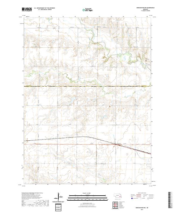
2021 Map of Dorchester NW
USGS Topo · Published 2021About this map
The West Fork Big Blue River meanders through this agricultural landscape along the border of Seward and Saline counties. The rural character is defined by a rigorous section-line road grid, including named routes like Rokeby Rd and Denton Rd, which navigate the subtle drainages of Johnson Cr and Sand Cr. For family historians, the presence of the Englehaupt Cem and West Mills Cem provides specific points of interest for tracing early local lineage. Small-scale water management is evident at Weber Reservoir in the southern half of the quadrangle. The land is predominantly organized under the Public Land Survey System, with township boundaries for t9n r2e and t8n r2e clearly delineating the traditional midwestern township and range structure.
Find a feature on this map
37 named features on this map. Tap any name to fly to it.
Don’t see what you’re looking for? This feature index may not catch every label — zoom into the map to look around manually.
Map Details
Editions of this 2021 Dorchester NW Map
This is the sole edition of this map. No revisions or reprints were ever made.
Other maps of this area

1934 · Seward
USGS Topo · 1:48,000

1934 · Utica
USGS Topo · 1:62,500

1935 · Dorchester
USGS Topo · 1:48,000

1937 · Utica
USGS Topo · 1:62,500

1939 · Seward
USGS Topo · 1:62,500

1940 · Dorchester
USGS Topo · 1:62,500

1955 · Lincoln
USGS Topo · 1:250,000

1957 · Lincoln
USGS Topo · 1:250,000

1958 · Lincoln
USGS Topo · 1:250,000
1964 · Pleasant Hill
USGS Topo · 1:24,000