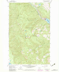
1962 Map of Doris Mountain
USGS Topo · Published 1983About this map
South Fork Flathead River carves a deep path through this portion of the Flathead National Forest, reflecting the era of postwar energy development in Montana. The northeastern corner of the map centers on the massive infrastructure of the Hungry Horse Reservoir, including the Powerhouse and Substation that transformed the regional landscape. This 1962 survey, with revisions from 1978, illustrates the transition from a remote wilderness to an industrial hydro-power hub.
Find a feature on this map
36 named features on this map. Tap any name to fly to it.
Don’t see what you’re looking for? This feature index may not catch every label — zoom into the map to look around manually.
Map Details
Editions of this 1962 Doris Mountain Map
2 editions found
Other maps of this area

1914 · Nyack
USGS Topo · 1:125,000

1943 · Kalispell
USGS Topo · 1:125,000

1957 · Kalispell
USGS Topo · 1:250,000

1960 · Kalispell
USGS Topo · 1:250,000

1960 · Cut Bank
USGS Topo · 1:250,000

1961 · Kalispell
USGS Topo · 1:250,000

1962 · Columbia Falls South
USGS Topo · 1:24,000

1962 · Doris Mountain
USGS Topo · 1:24,000

1962 · Hungry Horse
USGS Topo · 1:24,000

1962 · Creston
USGS Topo · 1:24,000