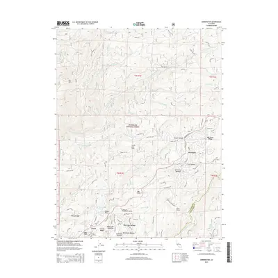
2015 Map of Dorrington
USGS Topo · Published 2015About this map
Blue Lake Springs and the surrounding Sierra Nevada foothills appear here as a dense network of mountain communities and forest service corridors. The transition from industrial logging roots to residential and recreational use is evident in the cluster of settlements including Arnold, White Pines, and Manuel Mill. The terrain is defined by dramatic drainage systems, specifically the S Fork Mokelumne River to the north and the N Fork Stanislaus River to the south, which carve through the Stanislaus National Forest.
Find a feature on this map
77 named features on this map. Tap any name to fly to it.
Don’t see what you’re looking for? This feature index may not catch every label — zoom into the map to look around manually.
Map Details
Editions of this 2015 Dorrington Map
This is the sole edition of this map. No revisions or reprints were ever made.
Other maps of this area

1891 · Big Trees
USGS Topo · 1:125,000

1894 · Big Trees
USGS Topo · 1:125,000

1897 · Big Trees
USGS Topo · 1:125,000

1901 · Big Trees
USGS Topo · 1:125,000

1947 · Sacramento
USGS Topo · 1:250,000

1948 · Sacramento
USGS Topo · 1:250,000

1948 · Columbia
USGS Topo · 1:62,500
1948 · Murphys
USGS Topo · 1:24,000

1948 · Stanislaus
USGS Topo · 1:24,000
1949 · Murphys
USGS Topo · 1:24,000