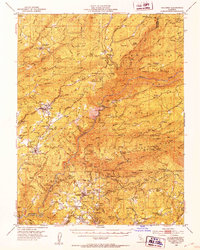
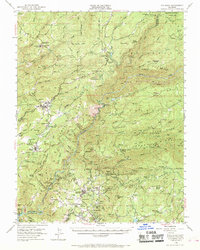
1948 Map of Columbia
USGS Topo · Published 1953About this map
The gold-bearing canyons and ridges of the Sierra Nevada foothills define this 1940s landscape, centered on the historic district of Columbia. This era shows the region transitioning from its deep mining roots toward a permanent residential and recreational identity, with the newly established Columbia Historic State Park preserving the core of the old town. Numerous active and dormant mining operations are scattered across the terrain, including the Sheep Ranch Mine, Contention Mine, and Republic Mine, reflecting the intensive industrial history of the Mother Lode.
Find a feature on this map
89 named features on this map. Tap any name to fly to it.
Don’t see what you’re looking for? This feature index may not catch every label — zoom into the map to look around manually.
Map Details
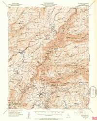
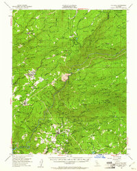
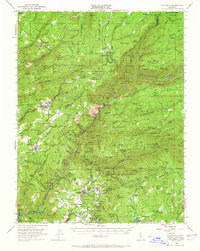
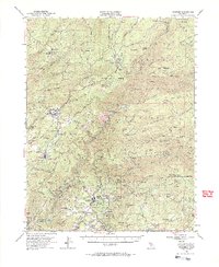
Editions of this 1948 Columbia Map
6 editions found
Other maps of this area

1889 · Jackson
USGS Topo · 1:125,000

1891 · Big Trees
USGS Topo · 1:125,000

1892 · Jackson
USGS Topo · 1:125,000

1893 · Sonora
USGS Topo · 1:125,000

1894 · Big Trees
USGS Topo · 1:125,000

1896 · Sonora
USGS Topo · 1:125,000

1897 · Jackson
USGS Topo · 1:125,000

1897 · Sonora
USGS Topo · 1:125,000

1897 · Big Trees
USGS Topo · 1:125,000

1898 · Sonora
USGS Topo · 1:125,000