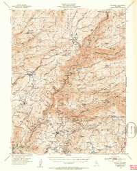
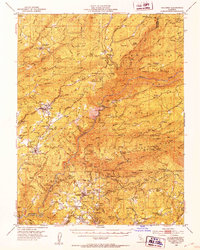
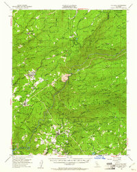
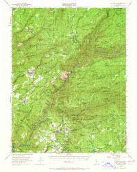
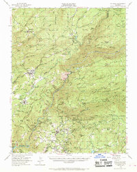
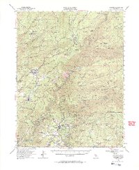
1948 Map of Columbia
USGS Topo · Published 1953About this map
The California Mother Lode's complex mining and hydraulic history is evident across this survey of the Columbia and Murphys area. At the map's center, the Stanislaus River and its forks carve through the terrain, supporting industrial infrastructure like the Stanislaus Powerhouse and Utica Powerhouse. The density of named mines and geological curiosities reflects a landscape heavily shaped by the Gold Rush, from the Golden River Mine and Sheep Ranch Mine to the subterranean wonders of Moaning Caves and Mercer Cave.
Find a feature on this map
146 named features on this map. Tap any name to fly to it.
Don’t see what you’re looking for? This feature index may not catch every label — zoom into the map to look around manually.
Map Details
Editions of this 1948 Columbia Map
6 editions found
Other maps of this area

1889 · Jackson
USGS Topo · 1:125,000

1891 · Big Trees
USGS Topo · 1:125,000

1892 · Jackson
USGS Topo · 1:125,000

1893 · Sonora
USGS Topo · 1:125,000

1894 · Big Trees
USGS Topo · 1:125,000

1896 · Sonora
USGS Topo · 1:125,000

1897 · Jackson
USGS Topo · 1:125,000

1897 · Sonora
USGS Topo · 1:125,000

1897 · Big Trees
USGS Topo · 1:125,000

1898 · Sonora
USGS Topo · 1:125,000