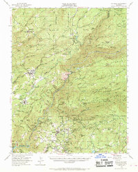
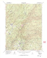
1948 Map of Columbia
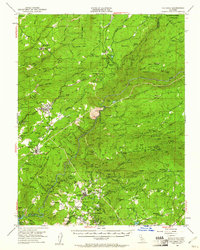
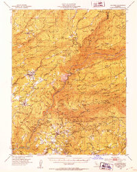
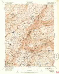
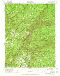
USGS Topo · Published 1961About this map
The Gold Country landscape of the Sierra Nevada foothills is documented here during a period of transition, where legacy mining operations met the growth of recreation and forest management. Columbia and Murphys stand as the primary hubs, with the former already protected by Columbia Historic State Park. The map reveals the intricate network of the Stanislaus River and its forks, which powered industrial sites like the Utica Powerhouse and Stanislaus Powerhouse.
Find a feature on this map
103 named features on this map. Tap any name to fly to it.
Don’t see what you’re looking for? This feature index may not catch every label — zoom into the map to look around manually.
Map Details
Editions of this 1948 Columbia Map
6 editions found
Other maps of this area

1889 · Jackson
USGS Topo · 1:125,000

1891 · Big Trees
USGS Topo · 1:125,000

1892 · Jackson
USGS Topo · 1:125,000

1893 · Sonora
USGS Topo · 1:125,000

1894 · Big Trees
USGS Topo · 1:125,000

1896 · Sonora
USGS Topo · 1:125,000

1897 · Jackson
USGS Topo · 1:125,000

1897 · Sonora
USGS Topo · 1:125,000

1897 · Big Trees
USGS Topo · 1:125,000

1898 · Sonora
USGS Topo · 1:125,000