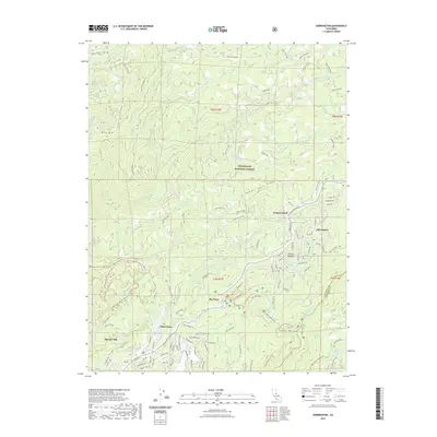
2022 Map of Dorrington
USGS Topo · Published 2022About this map
Stanislaus National Forest anchors this high-elevation landscape where the N Fork Stanislaus River carves through the Sierra Nevada foothills. The community of Dorrington serves as a central hub, surrounded by modern residential developments like those near White Pines Lake and Snowshoe Lake. The topography is defined by prominent landmarks such as Blue Mtn and the extensive Summit Level Ridge, while smaller pockets like French Meadow offer localized relief from the steep drainages of the S Fork Mokelumne River and its numerous tributaries. Historic infrastructure and timber-related activity are evident at Manuel Mill and Camp Menzies. The map also traces a complex network of forest routes and OHV trails, including the Dorrington Ohv Atv D52 510 Trl, reflecting the area's transition into a prime recreational destination within the Big Trees region.
Find a feature on this map
125 named features on this map. Tap any name to fly to it.
Don’t see what you’re looking for? This feature index may not catch every label — zoom into the map to look around manually.
Map Details
Editions of this 2022 Dorrington Map
This is the sole edition of this map. No revisions or reprints were ever made.
Other maps of this area

1891 · Big Trees
USGS Topo · 1:125,000

1894 · Big Trees
USGS Topo · 1:125,000

1897 · Big Trees
USGS Topo · 1:125,000

1901 · Big Trees
USGS Topo · 1:125,000

1947 · Sacramento
USGS Topo · 1:250,000

1948 · Sacramento
USGS Topo · 1:250,000

1948 · Columbia
USGS Topo · 1:62,500
1948 · Murphys
USGS Topo · 1:24,000

1948 · Stanislaus
USGS Topo · 1:24,000
1949 · Murphys
USGS Topo · 1:24,000