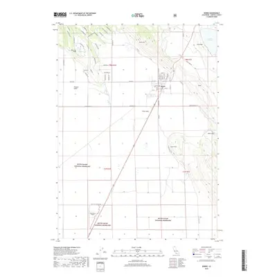
2018 Map of Dorris
USGS Topo · Published 2018About this map
Dorris sits near the northern edge of the Butte Valley National Grassland, occupying a high-desert landscape in Siskiyou County. The town is laid out on a grid that includes N Butte St and Seattle St, positioned just south of the Oregon border. To the west, Pleasant Valley and the Picard Cem recall the area's early settlement history, while the modern footprint of the Butte Valley Airport occupies the center of the valley floor. The geography is defined by prominent basaltic uplifts such as Dorris Hill, Otey Ridge, and D Hill, which overlook seasonal water bodies including Indian Tom Lake and Mud Lake. This survey illustrates the transition from the structured residential blocks of the town to the vast, open reaches of the federal grassland and the surrounding volcanic ridges.
Find a feature on this map
65 named features on this map. Tap any name to fly to it.
Don’t see what you’re looking for? This feature index may not catch every label — zoom into the map to look around manually.
Map Details
Editions of this 2018 Dorris Map
This is the sole edition of this map. No revisions or reprints were ever made.
Other maps of this area

1886 · Modoc Lava Bed
USGS Topo · 1:250,000

1886 · Shasta
USGS Topo · 1:250,000

1889 · Klamath
USGS Topo · 1:250,000

1891 · Ashland
USGS Topo · 1:250,000

1892 · Modoc Lava-Bed
USGS Topo · 1:250,000

1893 · Ashland
USGS Topo · 1:250,000

1894 · Klamath
USGS Topo · 1:250,000

1894 · Shasta
USGS Topo · 1:250,000

1897 · Ashland
USGS Topo · 1:250,000

1934 · Macdoel
USGS Topo · 1:96,000