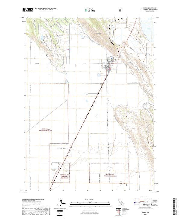
2021 Map of Dorris
USGS Topo · Published 2021About this map
Dorris serves as the central hub of this Siskiyou County landscape, situated at the northern edge of the expansive Butte Valley National Grassland. The settlement pattern reflects a transition from the agricultural expanse of Butte Valley to the more varied topography of Mud Lake Ridge and Otey Ridge. Local history is anchored by the Picard Cem, a significant marker of the area's early residents, while the modern infrastructure of the Butte Valley Airport supports the region's current connectivity. A network of local roads with evocative names like Sleepy Hollow Rd and Big Stump Rd weave through the hillsides near Dorris Hill. Natural landmarks such as Indian Tom Lake and Cedar Point provide distinct geographic anchors in a terrain defined by both high-desert ridges and lower seasonal basins like Mud Lake.
Find a feature on this map
66 named features on this map. Tap any name to fly to it.
Don’t see what you’re looking for? This feature index may not catch every label — zoom into the map to look around manually.
Map Details
Editions of this 2021 Dorris Map
This is the sole edition of this map. No revisions or reprints were ever made.
Historical Maps of Dorris Through Time
4 maps found