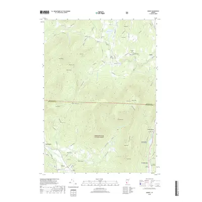
2018 Map of Dorset
USGS Topo · Published 2018About this map
Dorset and the surrounding Taconic peaks define this landscape at the edge of the Green Mountain National Forest. This 2018 survey details a cluster of high-elevation valleys and mountain settlements, including Dorset Hollow and Kirby Hollow, where the Mettawee River and Prentiss Brook begin their descent. For genealogists and local historians, the map is remarkably dense with named burial sites, recording family and community landmarks such as the Quaker - Staples Farm Cem, Read - Old Four Corners Cem, and the Blackmer - Hazelton Cem. The geography is dominated by the massive profile of Dorset Mountain and Dorset Peak, which tower over Danby and the former industrial pocket of Freedleyville. Natural features like the Emerald Lake Natural Bridge and the winding Tinmouth Rd Brook further illustrate the complex hydrology of this part of Rutland and Bennington counties.
Find a feature on this map
87 named features on this map. Tap any name to fly to it.
Don’t see what you’re looking for? This feature index may not catch every label — zoom into the map to look around manually.
Map Details
Editions of this 2018 Dorset Map
This is the sole edition of this map. No revisions or reprints were ever made.
Other maps of this area

1893 · Wallingford
USGS Topo · 1:62,500

1894 · Londonderry
USGS Topo · 1:62,500

1894 · Pawlet
USGS Topo · 1:62,500

1894 · Equinox
USGS Topo · 1:62,500

1896 · Equinox
USGS Topo · 1:62,500

1897 · Pawlet
USGS Topo · 1:62,500

1899 · Londonderry
USGS Topo · 1:62,500

1900 · Equinox
USGS Topo · 1:62,500

1903 · Mettawee
USGS Topo · 1:125,000

1950 · Glens Falls
USGS Topo · 1:250,000