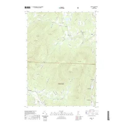
2021 Map of Dorset
USGS Topo · Published 2021About this map
The Green Mountain National Forest dominates this landscape, where the ridge of Dorset Mtn and the high summit of Dorset Peak overlook the narrow valleys of the Mettawee River and Mill Brook. This 2021 survey illustrates a distribution of small mountain settlements like Dorset Hollow and Freedleyville, connected by winding routes such as Lower Hollow Rd and Dorset Hollow Rd. The region’s deep family roots are preserved in numerous small burial grounds, including the Dillingham Cem and the uniquely named Quaker - Staples Farm Cem. Geologic curiosities like the Emerald Lake Natural Bridge near North Dorset stand alongside the rugged peaks of Netop Mtn and Woodlawn Mtn, highlighting the intersection of Vermont's geological heritage and its early agrarian and timber-related homesteads.
Find a feature on this map
96 named features on this map. Tap any name to fly to it.
Don’t see what you’re looking for? This feature index may not catch every label — zoom into the map to look around manually.
Map Details
Editions of this 2021 Dorset Map
This is the sole edition of this map. No revisions or reprints were ever made.
Other maps of this area

1893 · Wallingford
USGS Topo · 1:62,500

1894 · Londonderry
USGS Topo · 1:62,500

1894 · Pawlet
USGS Topo · 1:62,500

1894 · Equinox
USGS Topo · 1:62,500

1896 · Equinox
USGS Topo · 1:62,500

1897 · Pawlet
USGS Topo · 1:62,500

1899 · Londonderry
USGS Topo · 1:62,500

1900 · Equinox
USGS Topo · 1:62,500

1903 · Mettawee
USGS Topo · 1:125,000

1950 · Glens Falls
USGS Topo · 1:250,000