
1957 Map of Dos Cabezas
USGS Topo · Published 1959About this map
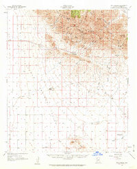
Dos Cabezas serves as the focal point of this mid-century topographic study, situated along the northern slopes of the Dos Cabezas Mountains. The settlement pattern here reflects a transitional landscape where high peaks like Dos Cabezas Peaks and Cooper Peak give way to the broad expanse of the Sulphur Springs Valley. Evidence of the region’s mining and ranching heritage is scattered across the terrain, from the Mascot Mine and its network of tunnels and prospects to the isolated Rancho Sacatal and Creasey Ranch further south.
Find a feature on this map
28 named features on this map. Tap any name to fly to it.
Don’t see what you’re looking for? This feature index may not catch every label — zoom into the map to look around manually.
Map Details
Editions of this 1957 Dos Cabezas Map
2 editions found
Other maps of this area

1916 · Pearce
USGS Topo · 1:125,000

1917 · San Simon
USGS Topo · 1:125,000

1917 · Chiricahua
USGS Topo · 1:125,000

1919 · Chiricahua
USGS Topo · 1:125,000

1922 · Willcox
USGS Topo · 1:125,000

1926 · Light
USGS Topo · 1:62,500

1926 · Cochise Head
USGS Topo · 1:62,500

1926 · Rucker
USGS Topo · 1:62,500

1926 · Courtland
USGS Topo · 1:62,500

1928 · Bowie
USGS Topo · 1:62,500