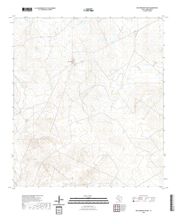
2022 Map of Dos Hermanos Peaks
USGS Topo · Published 2022About this map
Dos Hermanos Peaks rises as the central topographical landmark in this section of Webb County, defining a landscape carved by a network of intermittent waterways. These ephemeral streams, including Tierra Blanca Cr and Espada Cr, create a dendritic drainage pattern typical of the South Texas brush country. The map documents a predominantly rural ranching environment, where long-established routes like Eagle Pass Rd and Ranch Road 3370B provide the primary access through the scrubland. This 2022 survey illustrates the persistent isolation of the region, showing how contemporary land use remains tied to the natural contours and the seasonal flow of Espita Cr and Pinto Cr.
Find a feature on this map
7 named features on this map. Tap any name to fly to it.
Don’t see what you’re looking for? This feature index may not catch every label — zoom into the map to look around manually.
Map Details
Editions of this 2022 Dos Hermanos Peaks Map
This is the sole edition of this map. No revisions or reprints were ever made.
Other maps of this area

1923 · Palafox
USGS Topo · 1:62,500

1929 · Cotulla
USGS Topo · 1:125,000

1940 · Velenzuela Creek
USGS Topo · 1:62,500

1940 · San Loranzo Creek
USGS Topo · 1:62,500

1953 · Crystal City
USGS Topo · 1:250,000

1955 · Crystal City
USGS Topo · 1:250,000

1956 · Las Tiendas
USGS Topo · 1:62,500

1956 · Laredo
USGS Topo · 1:250,000

1961 · Crystal City
USGS Topo · 1:250,000
1965 · Las Tiendas
USGS Topo · 1:24,000