
1982 Map of Dos Hermanos Peaks
USGS Topo · Published 1982About this map
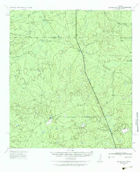
Dos Hermanos Peaks anchors this landscape in Webb County, rising above a dry-land drainage system characterized by intermittent waterways and cattle tanks. This 1982 provisional survey illustrates the ranching infrastructure of South Texas, where names like Lazarine Tank, Maquey Tank, and Corralitos Tank point to the critical importance of managed water sources in an arid environment. The terrain is defined by the winding paths of Espada Creek and Blanca Creek, which cut through the Tierra region. The mapping of small features such as Muerta Tank and Tasajillo Tank provides a detailed look at land use and specific landmark names used by local ranchers and land managers in the late twentieth century, long before modern digital satellite imagery replaced these hand-checked manuscript drawings.
Find a feature on this map
16 named features on this map. Tap any name to fly to it.
Don’t see what you’re looking for? This feature index may not catch every label — zoom into the map to look around manually.
Map Details
Editions of this 1982 Dos Hermanos Peaks Map
This is the sole edition of this map. No revisions or reprints were ever made.
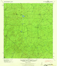
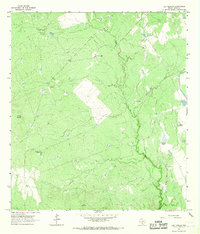
Other maps of this area

1923 · Palafox
USGS Topo · 1:62,500

1929 · Cotulla
USGS Topo · 1:125,000
1940 · Velenzuela Creek
USGS Topo · 1:62,500
1940 · San Loranzo Creek
USGS Topo · 1:62,500

1953 · Crystal City
USGS Topo · 1:250,000

1955 · Crystal City
USGS Topo · 1:250,000

1956 · Las Tiendas
USGS Topo · 1:62,500

1956 · Laredo
USGS Topo · 1:250,000

1961 · Crystal City
USGS Topo · 1:250,000
1965 · Las Tiendas
USGS Topo · 1:24,000