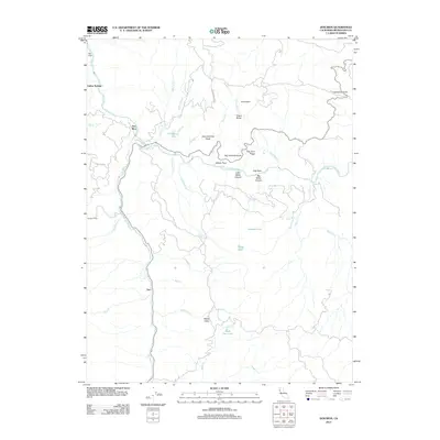
2012 Map of Dos Rios
USGS Topo · Published 2012About this map
The confluence of the Eel River and the Middle Fork Eel River defines this Mendocino County landscape, where the settlement of Dos Rios sits at the water's edge. This rugged interior region is characterized by steep ridges and isolated knobs, including Big Chemise Knob and Little Chemise Knob. To the south, the terrain descends toward Tatu and the Rodeo Valley, a stretch of land marked by seasonal drainages like Rodeo Cr and Dead Cow Lake.
Find a feature on this map
42 named features on this map. Tap any name to fly to it.
Don’t see what you’re looking for? This feature index may not catch every label — zoom into the map to look around manually.
Map Details
Editions of this 2012 Dos Rios Map
This is the sole edition of this map. No revisions or reprints were ever made.
Other maps of this area

1920 · Covelo
USGS Topo · 1:62,500

1926 · Covelo
USGS Topo · 1:62,500

1929 · Eden Valley
USGS Topo · 1:62,500

1951 · Laytonville
USGS Topo · 1:62,500

1952 · Spyrock
USGS Topo · 1:62,500

1952 · Eden Valley
USGS Topo · 1:62,500

1952 · Covelo
USGS Topo · 1:62,500

1957 · Ukiah
USGS Topo · 1:250,000

1960 · Ukiah
USGS Topo · 1:250,000
1966 · Longvale
USGS Topo · 1:24,000