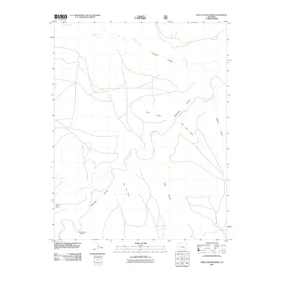
2011 Map of Doss Canyon North
USGS Topo · Published 2011About this map
The Purgatoire River carves a winding path through the center of this terrain, defining a landscape dominated by dramatic geological erosion and isolated canyon systems. In the early 21st century, the region remains largely open, with development concentrated around a network of unpaved paths and the lone corridor of County Rd 153 in the southeast. High ground is dissected by various drainage features, including the prominent Lockwood Canyon and the smaller Dead Horse Canyon to its south.
Find a feature on this map
14 named features on this map. Tap any name to fly to it.
Don’t see what you’re looking for? This feature index may not catch every label — zoom into the map to look around manually.
Map Details
Editions of this 2011 Doss Canyon North Map
This is the sole edition of this map. No revisions or reprints were ever made.
Other maps of this area

1891 · Timpas
USGS Topo · 1:125,000

1891 · Mesa De Maya
USGS Topo · 1:125,000

1893 · Mesa de Maya
USGS Topo · 1:125,000

1894 · Timpas
USGS Topo · 1:125,000

1955 · La Junta
USGS Topo · 1:250,000

1958 · La Junta
USGS Topo · 1:250,000

1968 · La Junta
USGS Topo · 1:250,000

1972 · Johnson Canyon
USGS Topo · 1:24,000

1972 · Doss Canyon North
USGS Topo · 1:24,000

1972 · Doss Canyon South
USGS Topo · 1:24,000